Submit Innovative Solutions
The U.S. Army Engineer Research and Development Center (ERDC) executes research and development (R&D) projects on behalf of the Assistant Secretary of the Army for Civil Works, U.S. Army Corps of Engineers (USACE), and various other government organizations. Investments in Civil Works are critical in generating near- and long-term benefits for securing our communities, supporting and growing our economy, creating jobs, and enhancing broader societal impacts such as improved public health, National security, recreation and tourism.
Strategic Focus Areas
NextGen Water Resources Infrastructure
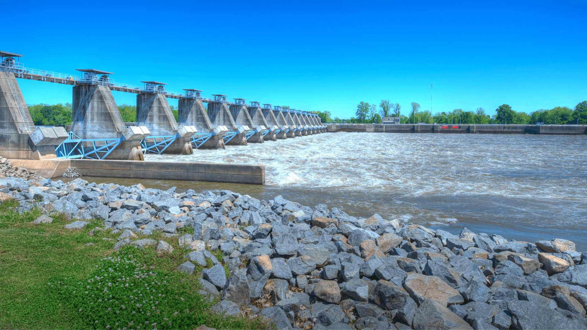
The NextGen Water Resources Infrastructure strategic focus area is driven by provisions in recent Water Resources Development Acts (WRDAs) on innovative materials, corrosion prevention, modeling technologies, and resilience that are not addressed in the current Civil Works R&D programs. Results are essential in addressing USACE asset management challenges with its existing inventory of aging infrastructure and ensuring improved reliability and resilience of new infrastructure.
Targeted strategic capabilities for this focus area are:
- Robotic Inspection and Repair: R&D activities will advance and enable robotic infrastructure inspections and robotic repair applications to USACE structures. Deploying robots will take workers out of underwater, dangerous, time-consuming, and disruptive activities, reducing worker injuries in hazardous inspection situations by up to 40% and reducing the cost of inspections of underwater equipment by as much as 70%. Robots will enable more frequent repairs, keeping major repairs at bay and projects operational.
- Novel and Sustainable Materials: Innovative construction materials, such as fiber-reinforced polymer composites, will be examined and piloted to create new alternatives for new and existing structures. The environmental and supply chain resilience will be investigated, allowing USACE to reduce the costs and increase the lifespan of its asset inventory. Concrete, steel, wood, and polymer materials will be included in research and pilot activities.
- Sensor and Testing Methods for Structures, Dams, and Levees: Sensors, inspections, and testing methods are necessary to determine operational performance and resilience of USACE infrastructure. New technologies will be developed that utilize emerging sensors, satellite- imagery, data acquisition, edge computing, and artificial intelligence to implement strategies across USACE to better assess and predict performance and potential failures at inland and coastal USACE structures (e.g. concrete, steel, timber, composites), levees, and dams. Focus will be to increase accuracy and availability of decision-support information while simultaneously decreasing the associated costs. These new technologies will increase project reliability, decrease downtime, avoid catastrophic failures, and decrease total cost of ownership for the USACE portfolio.
- Natural Disaster Damage Prediction and Mitigation: USACE has a large portfolio of assets that are vulnerable to flood and seismic damage and need to be retrofitted for resilience and performance. Research will develop seismic and flood performance prediction methods utilizing advanced modeling techniques, monitoring, and site characterization. New strategies will be developed and piloted to mitigate damage, such as vegetation approaches for overtopping of levees.
- Innovative Designs and Prototyping for Infrastructure Life Extension: Novel materials and advanced computing will enable USACE to rethink how infrastructure is designed and repaired, eliminating known weaknesses, decreasing costs, and greatly increasing reliability and performance of structures. This area will create new design models for various materials, a prototyping capability to prove the effectiveness of new designs prior to implementation, and document new computational-based design approaches for USACE engineers. Focused efforts will reduce risks associated with implementation of new technologies at mission-critical facilities.
- Advanced Manufacturing: Advanced manufacturing methods, such as 3D printing, will drastically reduce the lead time for replacing critical parts, allowing facilities to save cost and reduce downtime. The latest manufacturing innovations will be adapted for USACE infrastructure needs. The use of innovative manufacturing methods will reduce downtime of facilities caused by failed structural components by as much as 80% due to decreased fabrication and procurement time and reduce costs by eliminating the need to stockpile replacement components. Further, new design approaches with shapes impossible to produce without innovative manufacturing will decrease cost and increase reliability and safety of the USACE infrastructure portfolio.
- Innovations in Hydropower: Innovative designs, repair methods, inspection technologies, and novel materials will be developed and piloted to reduce the cost of ownership and increase the reliability of hydropower generation equipment.
- Advanced Coatings and Corrosion Mitigation: Corrosion is a major cause of maintenance for USACE. New alternatives for both coatings (e.g. paints) and corrosion mitigation technologies will be researched. Strong consideration to the environmental acceptability and cost of implementation for coatings will be given. Innovative corrosion control systems will be developed and piloted. New technologies for corrosion mitigation will reduce maintenance costs and increase the reliability of USACE infrastructure.
- Systems Engineering for Optimal Maintenance: Methodologies and tools will be developed that optimize efforts associated with prioritizing maintenance. These tools will be risk-informed and based on objective measurements, resulting in accurate project condition and performance assessments used to allocate funding to the most critical components, maximizing the reliability of the infrastructure portfolio. These tools will utilize systems engineering methods and allow decision-makers to manage the national portfolio more efficiently and effectively.
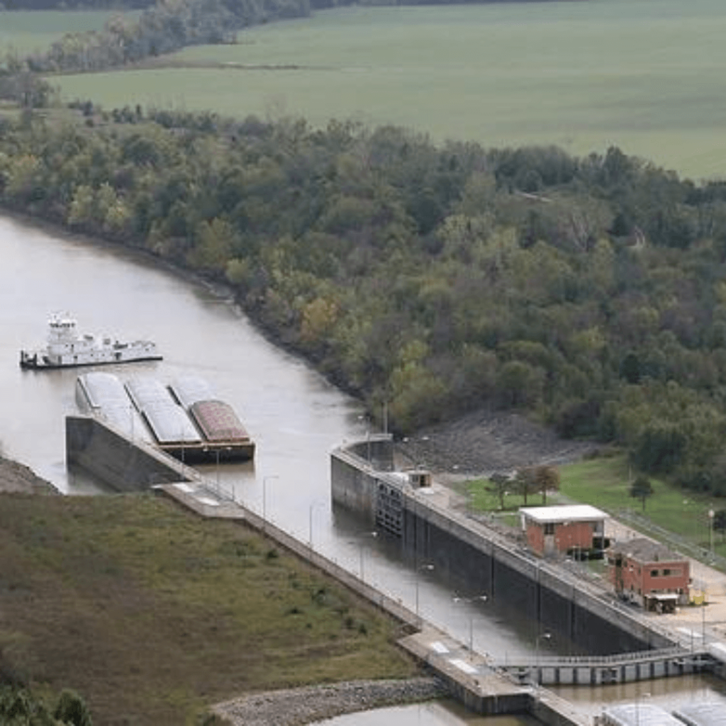
Innovation in Sediment Management
Innovation in Sediment Management is focused on technology discovery, development, and delivery at field-scale of innovative solutions for efficiently and sustainably managing sediment. Solutions to be developed include modeling and simulation focused on integrated tools to forecast life-cycle dynamics of sediment systems, mapping and modeling tools to identify and focus pollutant management at upstream sources, development of novel approaches for beneficial use, next-generation dredging and construction technologies that make use of autonomous systems, and advanced near-real-time modeling and sensing capabilities to support SMART (Specific, Measurable, Attainable, Risk Informed, Timely) planning and efficient operations.
Targeted strategic capabilities for this focus area are:
- Innovative Dredging Approaches: In partnership with industry and regulating authorities, assess, evaluate and pilot dredging methods and techniques not traditionally used by USACE to determine effectiveness and applicability across the portfolio of navigation and flood risk management needs for removing sediment. These non-traditional dredging methods offer means of reducing costs while eliminating the need for material placement activities.
- Improved Dredged Material Placement: Identify demonstration projects to pilot and evaluate efficacy of various dredged material placement approaches and techniques to lower costs of future dredging activities by minimizing handling of the dredged material. Placement of material such that natural processes can deliver it to desired locations, such as to wetlands or beaches for nourishment, lower overall dredging costs while increasing the sustainability of those features.
- Alternative Methods to Prevent Undesired Sedimentation: Explore, develop, and evaluate methods that prevent undesired sediment accumulation in channels and reservoirs by keeping the material moving or by capturing the sediment closer to sources, thereby lowering dredging requirements and increasing the availability of channels and reservoirs to meet navigation and flood risk management objectives.
- Develop Automation and Autonomous Capabilities: Discover, develop, and evaluate automation and autonomous control capabilities potentially applicable for surveying, dredging, and various types of observations. Successful implementation will improve and enhance operational capabilities through greater project situational awareness while raising the USACE safety posture.
- Improve Sediment Transport Predictive Capabilities: Expand knowledge about sediment transport processes and incorporate that into predictive tools that more accurately support planning studies, design, construction and sustainment of nature-based features and expand beneficial use of dredged material.
- Real-time Monitoring for Dredging: Next-generation sensors will be developed, assessed, and demonstrated to detect contaminants of concern, monitor turbidity plumes, and identify objects of interest to inform operational decisions, resulting in lower operational risk and greater percentage of production time.
- Advancing Dredged Material Construction Methods: Evaluate and assess technologies, equipment, and practices for placing dredged material in a controlled environment to better define specific physical processes connected with multiple variables routinely experienced in real projects. The improved knowledge to predict material placement results informs guidance and contract specifications that lower contractor risk and project costs while resulting in more effective and efficient construction of sustainable structures and nature-based solutions, enabling to USACE to meet goals and objectives for beneficial use of dredged material.
- Expand Crowdsourced Data Collection: Better understanding and awareness of project conditions and characteristics will be attained via crowdsourced data collection. Predictive tools and situational awareness are improved with expanded, accurate depiction of in-situ conditions. Crowdsourced data collection lowers condition uncertainty without increasing direct project costs.
- Develop Generational Advancements for Coastal Mapping: Lower costs and improve speed of collecting coastal sediment data and quantifying morphological changes and conditions though generational advancements to coastal mapping sensors and data processing tools. Information obtained are important to improve navigation, flood risk management, environmental restoration, and emergency operations mission delivery.
- Develop Metrics and Methods to Assess Beneficial Use of Dredged Material Projects: Establish metrics for assessing performance of and quantifying costs and benefits connected to beneficial use of dredged material projects. Performance assessments inform design improvements for nature-based solutions, and cost-benefit tools utilizing most relevant metrics better inform project decisions that maximize value for the Nation.
Comprehensive Water Risk Management
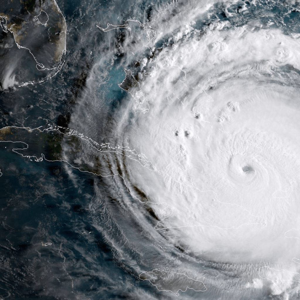
Comprehensive Water Risk Management will bridge knowledge gaps between weather, water systems, and their impacts with a continental-scale capability to manage hydro-terrestrial risk. Quantifying the hydro-terrestrial system is not only key to flood risk reduction but is required for efficient and effective execution of the navigation and environmental missions of the Corps, and to understand the impacts on communities. The purpose of this program is to discover, develop, and deliver a framework to improve our understanding and prediction of the risks associated with multi-hazard scenarios. This comprehensive data-simulation framework must be coordinated across Government agencies and will be complimentary to the Corps Water Management System, covering a broader range of processes, geography, and time frames to streamline analyses and reduce uncertainties, including assessment on social, environmental, and economic benefits.
Targeted strategic capabilities for this focus area are:
- Integrated Remote and In Situ Sensing Data: Remote and in situ sensing of atmospheric, ocean and land surface data assimilated in near-real time, and continuous assimilation of data for model calibration and validation. As more remote sensing assets come on-line (e.g., radar, hyper-spectral imaging), the SFA will target automated processing and decision inference to rapidly update water model data and predictions. R&D work packages will leverage advanced capability to integrate observations from disparate space and time scales.
- Risk-Informed Decision Support: Efficient ensemble approaches to quantify uncertainty, hazard assessment tools for risk-based project design and operation over seasonal projections.
- National Simulation Framework: Collaborating across agencies and partnering with academia and industry to deliver a real-time High-Resolution National hydro- terrestrial simulation framework for community resilience, including a common operating framework to evaluate comprehensive water-related hazards, providing a driver for sediment, ecosystem infrastructure, and crisis assessments.
- Couplings, Linkages, and Feedback between Natural and Built Ecosystems: Advances are needed for interlinked processes and response in a non-stationary environment. For example, coastal storm impacts are exacerbated through combined surge, wave, precipitation, riverine and groundwater that compound between different regions. These impacts vary in time and space as hurricanes move inland, increasingly unpredictable river flow patterns and as precipitation runoff inundates already stressed communities. Compound processes, such as rain-on-snow, remain poorly understood but cause widespread damage.
- Arctic Processes: Permanently frozen ground, seasonally frozen oceans, and the highest rates of environmental change on Earth pose unique challenges for flood and erosion management in the Arctic. Observations of how these processes are coupled are needed to develop models that reproduce events related to storms and long-term trends.
- Groundwater and Drought: Extreme droughts are increasing around the planet, but are particularly stressful in the American west, where much of our population’s food resources originate. Better understanding of the interactions between surface and ground water storage, reservoir and canal storage, and changing storm regimes is required to manage the Corps water supply and environmental sustainability missions.
- Support for Community Resilience: Technologies will integrate with risk-informed decision support tools to assess and quantify the effects of water resources conditions and benefits of potential interventions on impacted communities.
Innovative Applications of Big Data Analytics, AI and Autonomy
Currently not accepting submissions
Technologies will be developed to fully utilize data science and advanced computing techniques to address Civil Works challenges. Solutions include the use of Artificial Intelligence and Machine Learning (AI/ML) capabilities, computing on the edge, and high-performance computing to incorporate data analytics into operational decisions across the Corps. This focus area will enable USACE with cross-cutting data science tools for data engineering, data analysis, and data visualization that will support the other five strategic focus areas.
Targeted strategic capabilities for this focus area are:
- Data Engineering: Automating data collection, generating AI ready data (conducting data curation, analysis, and fusion), and developing the strategy and policy for data collection and utilization, to provide a framework for visualizing and interacting with AI-ready data.
- AI-Powered Decision Making: leveraging AI ready data to develop AI-ML tools as well as computationally intensive models and simulations to support human- assisted decision making. These tools provide automated forecasting for civil works operations and maintenance, automated approaches for construction operations and maintenance via digital twining, and visualization of models and simulations through developed assisted and virtual reality (XR) tools.
- Cyber Operational Technology (OT): leveraging AI-ML, data analytics, and cyber technologies to provide defensive tooling capabilities and processes to detect and prevent adversarial attacks through emulation and resiliency testing of adversarial traffic; monitoring for cyber threats and sustainment to enable early detection and mitigation of focused attacks on the models, data, and infrastructure.
- Autonomy: leveraging robotics, data, and AI-ML technologies to develop autonomous maneuvering and mapping of internal USACE inland and wetland infrastructures, developing automated USACE-owned software/hardware architecture for navigation of robots; developing interoperability between air, ground, and water robotics operations.
Crisis Preparedness, Response and Recovery
Crisis Mitigation Response and Recovery will develop technologies that enable USACE to sustain infrastructure performance and operations through combinations of known and unknown pressures and events in order to enhance the long-term resilience of our systems. The effort will focus on developing modeling and analytics to forecast infrastructure response that will enable “war-gaming” performance, recovery, and resilience under diverse events along with rapid data collection and decision support tools for USACE and interagency mission requirements.
Targeted strategic capabilities for this focus area are:
- Communication and Response Technologies: Tools and approaches for advanced real-time risk communication and dissemination, logistics for materiel solutions and transportation networks. This includes tools to collect and analyze data to link recovery strategies and flood risk management alternatives across different scenarios.
- Multi-Hazard Crisis Modeling Capabilities: Advanced multi-hazard modeling tools that provide broad and quantitative impacts beyond project scale including infrastructure, environment, community issues and war-gaming complex scenarios.
- Advanced Reconnaissance Technologies: Unmanned and autonomous systems for reconnaissance and advanced data collection systems linked to geospatial tools and enterprise and interagency databases.
- Risk Science and Decision Support: Integration of data and models for robust data-driven optimized decision support tools, including engineering to support community resilience and economics.
- Debris Removal Technologies: Developing unmanned and autonomous equipment and sensors to increase the speed and efficiency of debris estimation, classification, and characterization into appropriate waste streams, while reducing risk to USACE personnel in normal operations and in hazardous/high-risk. These capabilities will ensure the continuity of operations during crisis events and help reduce recovery costs.
- Temporary Power for Critical Infrastructure: Improved power assessment tools for critical infrastructure, optimizing available temporary power assets, and integrating hybrid technologies to efficiently increase energy availability, reduce post-disaster logistics requirements, and enables seamless integration into existing renewable energy infrastructure.
- Virtual Environments for Training & Testing: Develop virtual/augmented reality exercise and training environment that simulates crisis scenarios to enhance USACE emergency response team preparedness and evaluate emerging technology to support crisis action plans.
- Watershed Scale Emergency Management: Develop watershed-level screening tools for Emergency Management and Flood Risk Management that includes data visualization information analytics and modeling tools to integrate community perspectives, enhancing stakeholder outreach and analysis for tactical decision-making.
- Post-Wildfire Risk Management: Modeling tools to assess how spatial and temporal post-fire flood risks are distributed across vulnerable communities and improve the prioritization of post-fire recovery decisions to mitigate flood and ecosystem risks based on region-specific conditions.
- Reducing Infrastructure Vulnerability: Develop enterprise-wide tools to account for infrastructure vulnerability to the increasing frequency of extreme weather events in the 10-30 year time scale, identify at-risk assets and the data needed for skillful decision making through projected flood hazards (e.g. rain-on-snow, atmospheric river flooding, extreme drought, freeze thaw, ice jams, extreme temperatures).
Sustainable Species Management
Currently not accepting submissions
Managing invasive species and protecting threatened and endangered species each pose significant challenges to our nation’s resources and economy. Developing and adopting advanced technologies and methodologies for sustainable species management through collaboration and partnership is crucial for effective environmental stewardship and delivery of the USACE aquatic ecosystem restoration (AER) mission.
Targeted strategic capabilities for this focus area are:
- Resilient Aquatic Ecosystem Restoration: Accurately evaluating ecosystem structure, function, resilience, and sustainability; advanced environmental health monitoring and rapid-response adaptive management strategies for proactive planning for aquatic ecosystem restoration across the lifecycle of the projects.
- Environmental Decision Support to Increase USACE Mission Readiness: Advanced data-driven decision-support tools, novel methodologies, and best management practices for use by planning, operations and maintenance, engineering and construction, and other USACE mission areas to accelerate environmental compliance requirements, streamline decision making, decrease resources and time required to enhance natural resource stewardship and overall mission readiness.
- Management of Threatened & Endangered (T&E) Species: Innovative sensors, advanced prediction, and real-time monitoring of species occurrence and movement; managing species recovery through proactive aquatic ecosystem restoration and sustainable water resource management to minimize impacts of USACE navigation (dredging windows, habitat restrictions) and ecosystem restoration.
- Comprehensive Invasive Species Detection, Prevention, and Management: Real-time detection technologies through sensor development, prevention of new introductions through next-generation ecological modeling, and integrated management strategies for sustainable natural resource management.
Submissions will be reviewed by ERDC or other Government subject matter experts. Solutions received in response to this announcement will be selected based upon an initial review of how innovative and feasible the solution is at solving an agency challenge, the potential to enhance the mission effectiveness of the agency, and funding availability.
All resultant contracts will be firm-fixed price. All items, technologies, and services (including research and development) procured via this CSO are treated as commercial. ERDC is conducting this CSO on a full and open basis and intends to award contracts in accordance with FAR part 12 and the FAR part that is deemed most appropriate for the solution proposed (i.e., FAR part 13, 15, and/or 35). FAR/DFAR clauses will be integrated into contracts on a case-by-case basis based on proposed scope.
Additional terms and conditions may be required as circumstances necessitate; examples of such would be data rights, security, R&D, educational institutions, etc. The government does not plan to engage in the debrief process outlined in FAR part 15 but will provide feedback to unsuccessful offerors as appropriate and at its discretion. Award may be made using any appropriate vehicle (e.g., FAR-based contracts and Other Transactions) in accordance with applicable authorities that are effective at the time of the award.
How to Participate
1. Review the CSO Solicitation
2. Review FAQ
3. Once the solution is ready to submit, complete the submission form
Questions: Please send all technical and administrative questions using this form. Q&A will be updated periodically. It is the responsibility of the offeror to review Q&A prior to submitting a proposal.